Do you want to walk on the highest cliffs in Salento, among caves inhabited in prehistoric times, dry-stone walls and flowers that grow only here? This guide takes you to the Parco naturale regionale Costa Otranto – Santa Maria di Leuca e Bosco di Tricase (regional nature park), the protected area that follows the Adriatic coast from the Capo di Leuca up to Otranto: when it was created, what it protects, the Quercia Vallonea dei Cento Cavalieri (a valonia oak) and the Tricase wood and, above all, the trails and views of the stretch closest to our houses, between Leuca, the Ciolo, Novaglie, Marina Serra, Tricase Porto and Castro, with the rules to respect, the right season and practical tips.
In short
The Parco naturale regionale Costa Otranto – Santa Maria di Leuca e Bosco di Tricase, often simply called the Otranto-Leuca Park, is a protected area of the Puglia Region established by regional law no. 30 of 26 October 2006. It covers about 3,200 hectares along almost 60 km of Adriatic coast, from Torre del Serpe, at the gates of Otranto, to the lighthouse of Santa Maria di Leuca, across the territory of 12 municipalities. It protects sheer sea cliffs, karst caves used since prehistoric times, plants that grow only in Salento, such as the Leuca knapweed, and the Bosco di Tricase, the only valonia oak wood in Italy. You discover it on foot, on a network of waymarked trails: near our houses the most famous is the Sentiero delle Cipolliane, between the Ciolo and Novaglie. The best times to walk are spring and autumn.
What is the Otranto-Leuca Coast Park?
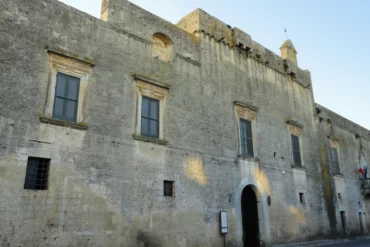
It is the largest of the regional parks established in the province of Lecce: a long strip of high, rocky coast on the eastern side of Salento, with the terraced countryside, the Mediterranean scrub and the pastures behind it. The park is managed by a consortium of the municipalities, set up on 29 July 2008, based in the castle of Andrano, and includes three sites of the European Natura 2000 network: Costa Otranto – Santa Maria di Leuca, Boschetto di Tricase and Parco delle querce di Castro.
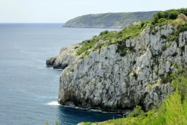
The park has no gates or ticket offices: it is the coast itself. Following the coast road from Leuca towards Otranto, which the park considers its backbone, you pass cliffs tens of metres high, gullies carved by water, watchtowers, pajare (dry-stone huts) and dry-stone walls, with a deep, clear sea below you. Behind the cliffs there are olive groves on stone terraces and large dry grasslands, the pastures of the past.
In this guide you will first find what the park protects and why it is so special, then a practical part devoted to the southernmost stretch, around our houses: the trails of the Ciolo and the Cipolliane, the Vie del Sale of Corsano, the valonia oak wood of Tricase and the views as far as Castro, with the rules to respect, the best months and how to reach the start of the trails.
Curiosities and atmosphere
This stretch of coast is like an island: a rocky area, ecologically isolated from the rest of Salento and just 80 km from the Balkans. This is why very rare plants and animals have found refuge here, some endemic, meaning found only here, others «amphi-Adriatic», living only on the two shores of the Adriatic. On the limestone crags dropping sheer into the sea grows the Leuca knapweed (Centaurea leucadea), with purple flowers and leaves covered in whitish down: it is a very rare species that lives only on the coast between the Capo di Leuca and Tricase and flowers between June and July. Alongside it grow the noble knapweed, the Salento pink, the Leuca alyssum and the Apulian bellflower, while several wild orchids bloom in the pastures. At Porto Badisco grows Giacomini’s vetch, a plant that exists only there.
Dry grasslands cover about three quarters of the park and are a priority habitat for the European Union: for centuries they were grazing land for flocks. Along the coast there are a great many karst caves, some partly submerged: in the Zinzulusa, the Grotta Romanelli and the Grotta dei Cervi, remains from the Palaeolithic and Neolithic have been found, and it was in these very caves that the last presence of the monk seal in Puglia was recorded. Small rare crustaceans live in the underground waters, along with a sponge known only in the Zinzulusa. The park is also a passage route for migratory birds, including the osprey, the marsh harrier and several species of harriers.
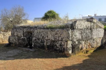
And then there is the stone: kilometres of dry-stone walls, pajare and «mantagnate», massive dry-stone walls more than two metres high that farmers built to shelter olive, fig and pear trees from the sea wind. In the Bosco di Tricase, which gives the park its name, grows the valonia oak instead, a Balkan tree that here forms the only wood of this species in Italy: it is the only Salento tree on the national red list of threatened species.
Where it is and how to reach it
The park follows the eastern coast of Salento, in the province of Lecce, from Santa Maria di Leuca to Otranto, and also includes Punta Palascìa, the easternmost point of Italy. There are twelve municipalities: Castrignano del Capo, Gagliano del Capo, Alessano, Corsano, Tiggiano, Tricase, Andrano, Diso, Ortelle, Castro, Santa Cesarea Terme and Otranto. In this guide we focus on the southernmost stretch, between Leuca and Castro, where our houses are. The reference point is the Ponte del Ciolo, in Gagliano del Capo: from here the Leuca lighthouse is 6.6 km away, Marina di Novaglie 2.5 km, Marina Serra 9 km, Tricase Porto 12 km and Castro 21 km. Lecce is about 66 km away, just over an hour by car.
By car: from Lecce take the SS16 to Maglie and then the SS275 towards Santa Maria di Leuca, turning off towards the Adriatic coast. The coast road links all the park’s seaside villages, from Leuca to the Ciolo, Novaglie, Marina Serra, Tricase Porto, Marina di Andrano and Castro. At the Ciolo there is a public car park next to the bridge, where the trails start; in August it fills up early.
By public transport: the Ferrovie del Sud Est line runs as far as Gagliano Leuca station, in Gagliano del Capo; national trains arrive in Lecce. The most convenient airport is Brindisi, about two hours’ drive from the Ciolo. In summer the «Salento in Bus» lines connect many places along the coast: check the routes and timetables for the current year. To get from one trail to another, however, a car is still the most convenient option. Maps, route sheets and GPS tracks of the trails are on the website Sentieri nel Parco.
What to do and what to see
The park is best experienced on foot: early in the morning on the trails along the clifftops, then a swim in a small cove, and in the afternoon a wood or a tower. Here are the trails and places not to miss in the southern stretch, starting from the Ponte del Ciolo and heading up the coast. Distances and driving times from the Ciolo are approximate; trail lengths, times and difficulty grades are those given by the park.
1. The Sentiero delle Cipolliane, from the Ciolo to Novaglie (2 hours there and back)
It is the most famous trail on this stretch of coast. It starts from the public car park at the Ponte del Ciolo, where a panel sums up the route, and follows a very old drovers’ track north between dry-stone walls, high on the cliff, as far as Marina di Novaglie. It is about 2 km long, takes one hour one way and is graded E (escursionistico, hiking). Along the way you pass olive terraces dropping sheer into the sea, scrub of mastic, myrtle and tree spurge, prickly pears, stone pajare and tall mantagnate; in several places there is a wooden handrail and a few benches so you can enjoy the view. The last 400 metres go down stone steps to via Amerigo Vespucci, near the little harbour of Novaglie. Read our guide to Marina di Novaglie.
2. The Grotte Cipolliane (45 minutes)
About one and a half kilometres from the Ciolo, the trail reaches the top of the cliff in which the Grotte Cipolliane open, about 40 metres above the sea, with a rest area and an illustrated panel telling their story: the caves were used by Palaeolithic people and are a key site for the prehistory of Salento. To go down you take a steep, rough path, graded EE, for experienced hikers, to be tackled with great care. The caves are three chambers in a row overlooking the sea: according to the park, only the first two can be crossed, with caution, while the third can be accessed only with the authorisation of the park authority (Ente Parco). Then you climb back up the same path and continue your walk.
3. The Canalone del Ciolo and the canyon trails (1 hour)
At the Ciolo the coast road crosses, on a bridge, a natural canyon with towering walls, full of caves and covered in scrub. The Sentiero Canalone del Ciolo goes down steps from the bridge to the small inlet, then climbs the bottom of the canyon for about 700 metres, over rock and natural steps, with stretches of boardwalk and wooden handrail: you pass the Grotta dei Conigli and the walls equipped for sport climbing, up to a small panoramic rest area. The park reckons on just over half an hour, difficulty E. The Sentiero delle Prazziche also starts from the Ciolo, as does, to the south, the Itinerario delle Mannute, which takes in caves such as the Grotta dei Libri and the Grotta delle Mannute: it is recommended only for experienced hikers or with a guide. For the town, the cove and the bridge, read our guide to Gagliano del Capo.
4. The Vie del Sale of Corsano and Torre Nasparo (half a day)
Just north of Novaglie, at Marina di Corsano, the Vie del Sale (salt roads) run down to the sea: old drovers’ tracks that linked the town to the coast, where people gathered the salt left in the rock pools by evaporated seawater. The Funnuvojere – Calavedda track runs parallel to the sea between dry-stone walls, mantagnate and stretches of rock on the clifftops. The park joins them in the Itinerario Vie del Sale, a loop of about 13 km and more than six hours’ walking that starts from Marina Serra, passes above the Grotta Matrona, reaches Torre Nasparo (7 km from the Ciolo, 9 minutes), goes down to Marina di Corsano and climbs back up to the Torre Specchia Grande. You can also do just part of it: from Torre Nasparo, on clear days, you can see the Punta Palascìa lighthouse to the north and the Leuca headland to the south. Take care on the Grotta del Soffio stretch, below the tower: storm surges move large boulders and in some places the trail disappears, which is why the park recommends following the GPS track. For the history of the towers, read our guide to the Salento coastal towers.
5. Marina Serra, the Torre del Sasso and Tricase Porto (half a day)
At Marina Serra (9 km from the Ciolo, 14 minutes) starts the Sentiero del Nemico, which climbs the coast above the Grotta Matrona towards Torre Nasparo. The famous natural pool below Torre Palane has been closed to swimming since February 2026, after a collapse of the cliff: before you go, check whether the ban is still in force. Read our guide to Marina Serra. Further north, above Tricase Porto, the Serra del Mito climbs to the Torre del Sasso: from the tower the view stretches from Torre Capo Lupo and Castro to Torre Nasparo, with the Strait of Otranto in front of you. In spring, on the white rocks below the tower, the Leuca alyssum and the great mullein with its long flower spikes bloom. The Itinerario del Mito, which starts from Castro, ends at Tricase Porto, where there is also the Porto Museo to visit. Read our guide to Tricase Porto.
6. The Quercia Vallonea dei Cento Cavalieri and the Bosco di Tricase (1-2 hours)
On the road between Tricase and Tricase Porto (11 km from the Ciolo, 16 minutes) stands the Quercia Vallonea dei Cento Cavalieri, one of the oldest trees in Italy: about 20 metres tall, with a trunk more than 4 metres in circumference and a crown of about 700 m². Sources estimate its age at between 700 and 900 years; legend has it that Frederick II of Swabia gathered his knights under its branches, hence the name, which means «of the Hundred Knights». In 2020 it represented Italy in the European Tree of the Year contest. From here the Sentiero delle Querce Vallonee, less than a kilometre on an old drovers’ track between dry-stone walls (20 minutes, also suitable for the Joelette), leads to the Bosco di Tricase, the valonia oak «biotope»: about 4 hectares owned by the municipality and managed by the park, with the Giardino delle vallonee, nature trails, panels, some of them tactile, and a play area. It is the only valonia oak wood in Italy and the westernmost outpost of this species in Europe. If you want to walk further, the Itinerario delle vallonee e delle sette pajare is a double loop of about 7 km that starts from the Chiesa dei Diavoli, a small octagonal church, and goes as far as the Torre del Sasso.
7. Marina di Andrano, the Cala dell’Acquaviva and Castro (half a day)
Heading up the coast, the park has its headquarters in the castle of Andrano (18 km from the Ciolo, 26 minutes), while below the town, at Marina di Andrano, the coast becomes lower and rockier. Read our guide to Marina di Andrano. A little further north, at Marittima (19 km, 30 minutes), the Sentiero Canalone dell’Acquaviva goes down stone steps from the provincial road into the gully, almost always in the shade of holm oaks and scrub, passes under the coast road bridge and in about 10 minutes reaches the cove, where a freshwater spring flows into the sea: put your feet in the water and you will feel the cooler springs. Read our guide to the Cala dell’Acquaviva. From here the Sentiero dell’Argentiera follows the low coast for about 6 km to the harbour of Castro (21 km from the Ciolo, 31 minutes): it is the first stretch of the Itinerario del Mito, which links Castro to Tricase Porto in about 14 km and six hours’ walking.
Salento Prime holiday homes: pick your dates and see at once which are free.
 Casa Amalia – Center of Tricasesleeps 4
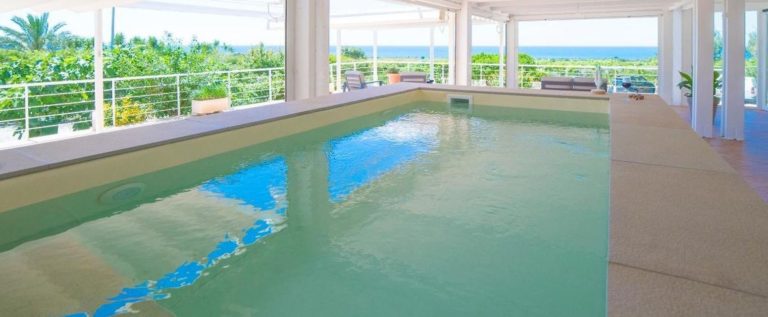 LE SECCHE SUITE & HOUSE – 2sleeps 4 · pool
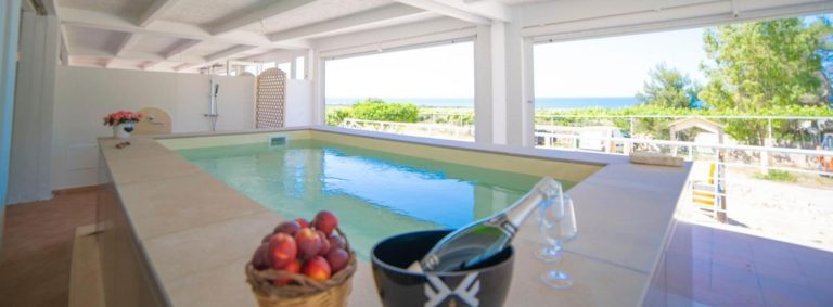 LE SECCHE SUITE & HOUSE – 1sleeps 4 · pool
Landscapes, trails and who they suit
In the southern stretch of the park the coast is high: limestone cliffs dropping sheer into the sea, broken by gullies such as the Ciolo and the Acquaviva, carved by fresh water over thousands of years. Above the cliffs are olive terraces, partly abandoned and reclaimed by the scrub, and higher up the rocky plateau with garrigue and dry grasslands. Further north, between Andrano and Castro, the coast gets lower and becomes a rocky shore with tide pools, rock samphire and glasswort.
Every trail in the park has a code, for example PNR COL B12 for the Sentiero delle Cipolliane, and a difficulty grade: T (turistico, tourist), for easy walks near the towns; E (escursionistico, hiking), with no technical difficulties; EE, for experienced hikers, on rough terrain or for routes over 5 km. The park is perfect for people who love walking, photography, watching plants and birds, for couples and for families with children used to walking. It is less suited to small children on the clifftop stretches and to anyone looking for shade: almost all the coastal trails are in the sun.
Access, services and accessibility
The park is open land, crossed by public roads and trails: there are no ticket offices or opening hours. At the start of the main routes you will find panels with the map and signs with the trail code; along the Sentiero delle Cipolliane there is also a rest area. For food and facilities there are the seaside villages and towns, such as Leuca, Novaglie, Tricase Porto and Castro: out of season, check locally what is open.
For people with reduced mobility the park provides the Joelette, a single-wheel off-road wheelchair which, with at least two companions, makes it possible to use the tourist and hiking trails: you request it with a form on the park’s trail website. In Santa Maria di Leuca there is also the accessible seafront, a wooden boardwalk of about 400 metres along the low rocky shore, usable by wheelchair with a companion, with a ramp down to the floating jetty.
The south of the park vs the north of the park
The park is long and varied. Here is a practical comparison to help you choose:
South (from Leuca to Tricase) vs north (from Castro to Otranto)
- South: towering cliffs, the Ciolo canyon, the Grotte Cipolliane, the Vie del Sale and the valonia oak wood of Tricase, near our houses
- North: the Grotta Zinzulusa in Castro, the pine wood of Santa Cesarea Terme, Punta Palascìa, the easternmost point of Italy, and the bauxite quarry of Otranto, about an hour’s drive from the Ciolo
The Sentiero delle Cipolliane vs the Itinerario Vie del Sale
- Cipolliane: about 2 km, one hour one way, well waymarked, with handrails, benches and the prehistoric caves halfway
- Vie del Sale: a loop of about 13 km, wilder, with stretches where the trail disappears and you need GPS
Half a day vs a full day
- Half a day: the Sentiero delle Cipolliane with the Canalone del Ciolo, or the Quercia Vallonea and the Bosco di Tricase
- A full day: the Itinerario del Mito from Castro to Tricase Porto, about 14 km, or the Vie del Sale loop
When to choose the south: if you want short trails to combine with a swim at the Ciolo or Novaglie and a quiet base between Leuca and Tricase.
When to choose the north: if you are interested in the great caves and the views of Otranto; but allow about an hour’s drive from the Ciolo to Punta Palascìa.
Practical tips
Specific rules apply in the park. The law that established it prohibits collecting samples of plants, animals, rocks, archaeological finds and fossils, damaging flora and fauna, driving motor vehicles through it, dumping waste and lighting fires. On the trails, the park points out, it is forbidden to pick plants or parts of plants without authorisation, to collect finds of any kind and to disturb or capture wild animals, which should be observed from a distance; waste must be carried back and left at the collection points outside the trails. So no flowers, no rock samphire from the rocks and no stones or fossils as souvenirs. If you want to fly a drone, find out about the rules in force first and keep away from the rock faces where birds live.
Then there is safety. On the cliffs always keep your distance from the edge, take care on rough or slippery stretches and do not touch or lean on unstable rocks, because they can come loose: the cliffs on this coast do collapse, and at Marina Serra a rockfall closed the natural pool in 2026. Respect barriers and closed trails, wear hiking shoes, not sandals, and carry plenty of water: there is very little shade along the coastal trails. In summer walk at dawn or in the late afternoon, and when the sea is stormy keep away from the low stretches near the water.
Useful practical information
| 📍 Where | Adriatic coast of Salento, from Santa Maria di Leuca to Otranto; the Ponte del Ciolo is 6.6 km from the Leuca lighthouse and 66 km from Lecce |
|---|---|
| 🚗 Parking | Public car park at the Ponte del Ciolo; at Novaglie, Marina Serra and Tricase Porto near the sea; in August arrive early |
| ♿ Access | Open and free; T and E trails also with the Joelette; descent to the Grotte Cipolliane for experienced hikers only |
| 🏖 Beach | No sand: small coves such as the Ciolo and the Acquaviva and low rocks at Novaglie and Tricase Porto |
| 🌊 Sea | Deep and crystal clear; in storm surges keep away from the low rocks |
| 👟 What to bring | Hiking shoes, plenty of water, a hat, sunscreen and the GPS track of the route |
| 🍴 Food | In the seaside villages and towns: Leuca, Novaglie, Tricase Porto, Castro; nothing along the trails |
| 📅 Best time | Spring and autumn for walking; in summer only at dawn or sunset |
When to go and how much time to plan
March, April and May: the best time for walking. Temperatures are mild, the pastures are green and full of flowers, including wild orchids, and the Leuca alyssum blooms on the rocks.
June: very long days and the sea already pleasant. On the crags between Leuca and Tricase the Leuca knapweed starts to flower, lasting until July. Walk early in the morning and then go for a swim.
July and August: it is very hot and there is no shade on the coastal trails. Walk only at dawn or towards evening, carry plenty of water and combine the walk with a swim at the Ciolo or Novaglie; in the hot hours choose the Bosco di Tricase, under the oaks.
September, October and November: in our opinion the best season for the trails. In September the sea is still warm, there are fewer people and the low afternoon light sets the cliffs aglow.
December to February: often clear, quiet days, good for longer routes such as the Vie del Sale. In storm surges, however, keep away from the low coast and the stretches near the water.
Events and festivals (indicative dates, check every year on the website of the municipality of Gagliano del Capo and on SalentoMe):
- Trofeo Ciolo, the mountain running race on the Sentiero del Ciolo: usually in June
- Patron saint’s feast of San Rocco in Gagliano del Capo, with procession, band and fireworks: in the second half of August
- Festa di San Nicola at Tricase Porto, with the procession of boats at sea: usually on 12 and 13 August
How much time to allow: half a day is enough for the Sentiero delle Cipolliane and the Canalone del Ciolo; a full day if you add the Quercia Vallonea and the Bosco di Tricase; two more days for the Vie del Sale and the Itinerario del Mito. A typical day in the south of the park:
- 7:00: set off from the Ponte del Ciolo on the Sentiero delle Cipolliane, with the sun rising from the sea
- 7:45: stop above the Grotte Cipolliane and, if you are experienced, go down to the first two chambers
- 8:30: arrive in Novaglie and return to the Ciolo on the same trail
- 10:30: the Sentiero Canalone del Ciolo and a swim in the little cove, if the sea is calm
- 13:30: lunch in Novaglie or in Gagliano del Capo
- 17:00: the Quercia Vallonea dei Cento Cavalieri and the Bosco di Tricase
- 19:30: a stroll and dinner at Tricase Porto
Surroundings and extra ideas
The park is almost 60 km long: here is what to add to the trails of the southern stretch. Distances and driving times from the Ponte del Ciolo are approximate.
Santa Maria di Leuca (6.6 km, 7 minutes): the lighthouse, the de Finibus Terrae sanctuary, the harbour with boats to the caves and the park’s accessible seafront, a wooden boardwalk on the low rocky shore. Read our guide to Santa Maria di Leuca.
Marina di Novaglie and the Grotta Azzurra (2.5 km, 4 minutes): from via Amerigo Vespucci a path of about 350 metres, ten minutes on foot, leads up above the Grotta Azzurra, a beautiful sea cave.
Torre Specchia Grande (4.8 km, 8 minutes): Corsano’s tower high on the coast, on the route of the Itinerario Vie del Sale, with a wide view over the sea.
The Grotta Zinzulusa in Castro (23 km, 35 minutes): one of the most important caves in the park, where prehistoric remains have been found and whose underground waters are home to a sponge known only here.
Punta Palascìa and Otranto (41 km, about an hour): the far north of the park, with the lighthouse on the easternmost point of Italy, the bauxite quarry and Torre del Serpe at the gates of Otranto.
Corsano, Alessano and Gagliano del Capo: the inland towns from which the old tracks ran down to the sea, a few minutes from the park’s coast.
Local tip
The park’s coast faces east: set off from the Ponte del Ciolo before dawn and walk towards Novaglie on the Sentiero delle Cipolliane. The sun rises from the sea in front of you, the cliffs turn pink and it is still cool. Stop on one of the benches or beside a pajara and look at the coast opening out towards Tricase.
Between June and July, on the rock faces dropping sheer into the sea, look out for the purple flowers of the Leuca knapweed: it grows only on this stretch of coast. Photograph it, but leave it where it is.
In the afternoon, when the sun beats down on the cliffs, move to Tricase and sit in the shade of the Quercia Vallonea dei Cento Cavalieri: it is the best way to understand why this park also has a wood in its name.
FAQ
Where is the Otranto-Leuca Coast Park?
On the Adriatic coast of Salento, in the province of Lecce, from Santa Maria di Leuca to Otranto, across the territory of 12 municipalities. It also includes Punta Palascìa, the easternmost point of Italy, and the Bosco di Tricase.
When was it established and how big is it?
It was established by the Puglia Region with regional law no. 30 of 26 October 2006. It covers about 3,200 hectares along almost 60 km of coast and is the largest regional park in the province of Lecce. It is managed by a consortium of the municipalities based in Andrano.
Do you have to pay to enter the park?
No: the park is open land, crossed by public roads and trails, with no ticket offices or opening hours. The protection rules, however, apply everywhere.
What is the most beautiful trail near Santa Maria di Leuca?
The Sentiero delle Cipolliane, which starts from the Ponte del Ciolo, a few minutes from Leuca, and ends at Marina di Novaglie: about 2 km, one hour one way, hiking difficulty, with the Grotte Cipolliane halfway.
Can you visit the Grotte Cipolliane?
Yes, with caution: you go down a steep path for experienced hikers. According to the park, only the first two chambers can be crossed; the third can be accessed only with the authorisation of the park authority (Ente Parco).
Where is the Quercia Vallonea dei Cento Cavalieri?
In Tricase, on the road that runs down from the town to Tricase Porto, not in Lucugnano. Its age is estimated at between 700 and 900 years, and next to it is the Bosco di Tricase, the only valonia oak wood in Italy.
What is not allowed in the park?
Collecting plants, flowers, rocks, fossils or finds, disturbing or capturing animals, lighting fires, dumping waste and driving motor vehicles through it. On the cliffs keep away from the edge and respect closed trails.
When does the Leuca knapweed flower?
Between June and July. It is a very rare plant that grows only on the limestone crags of the coast between the Capo di Leuca and Tricase: you can look at it and photograph it, but you must not pick it.
Is the park suitable for children and people with reduced mobility?
With children, choose short, easy routes, such as the Sentiero delle Querce Vallonee or the Grotta Azzurra path at Novaglie, and keep them away from the edge of the cliffs. For people with reduced mobility the park offers the Joelette, and in Leuca there is a wheelchair-accessible seafront.
Where to stay near the Otranto-Leuca Coast Park?
Between Marina di Novaglie and Marina di Corsano there is Salento Prime’s Villa Azzurra / Villa Panorama: up to 7 guests, 2 bathrooms, garden and terrace with sea views, 6 minutes by car from the Ponte del Ciolo and the Sentiero delle Cipolliane.
Conclusion
The Otranto – Santa Maria di Leuca Coast Park and Bosco di Tricase is Salento at its wildest: cliffs dropping sheer into a deep sea, caves inhabited in prehistoric times, flowers that exist only here, dry-stone walls and an oak many centuries old. Discover it on foot, setting off early, with the right shoes and plenty of water, and respect the park’s rules: it is the best way to leave it as it is for those who come after you.
If you want to stay a few minutes from the trails, between Marina di Novaglie and Marina di Corsano you will find our Villa Azzurra / Villa Panorama: up to 7 guests, 2 bathrooms and a large terrace with sea views, 6 minutes from the Ponte del Ciolo. You will find our houses in the area on the page holiday homes in Novaglie and Marina di Corsano.
Discover the available accommodations with Salento Prime. To best organize your base and transfers, contact us here or start a chat on WHATSAPP.
Cover photo: Paolo Damiano Dolce, CC BY-SA 4.0, via Wikimedia Commons, cropped